About this project
Cartem is a mobile GIS application dedicated to the agents of a large French energy transport company.
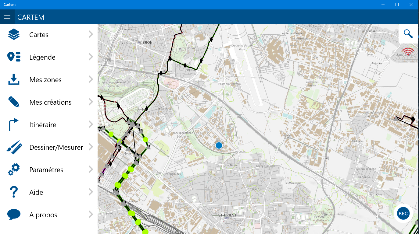
The application allows agents to view the entire assets of the company directly on a map from their smartphones, and to exploit the data related to those assets (pylons, underground lines, HDVC lines, etc.).
Initially, a native iOS application was developed by another IT company. The company, willing to change their iPhones fleet for more powerful Windows Phone tablets, turned to Sully Group to replace the existing application with a new cross-platform version.
I was in charge of the third-party application maintenance of the native iOS application, as well as the development of the new cross-platform version with a team of Xamarin developers.
Technologies


Target platform


Characteristics
Filtres and dynamic display : in order to not clutter the user with unnecessary surplus information, and to improve performance, the user can choose to display multiple layers of information. These filters are dynamic, configurable from a back office.
The display of informations and the map is done with the ESRI SDK.
Although the request is specifically in Windows Phone, Cartem is cross-platform and will also work under Android and iOS with some small changes.
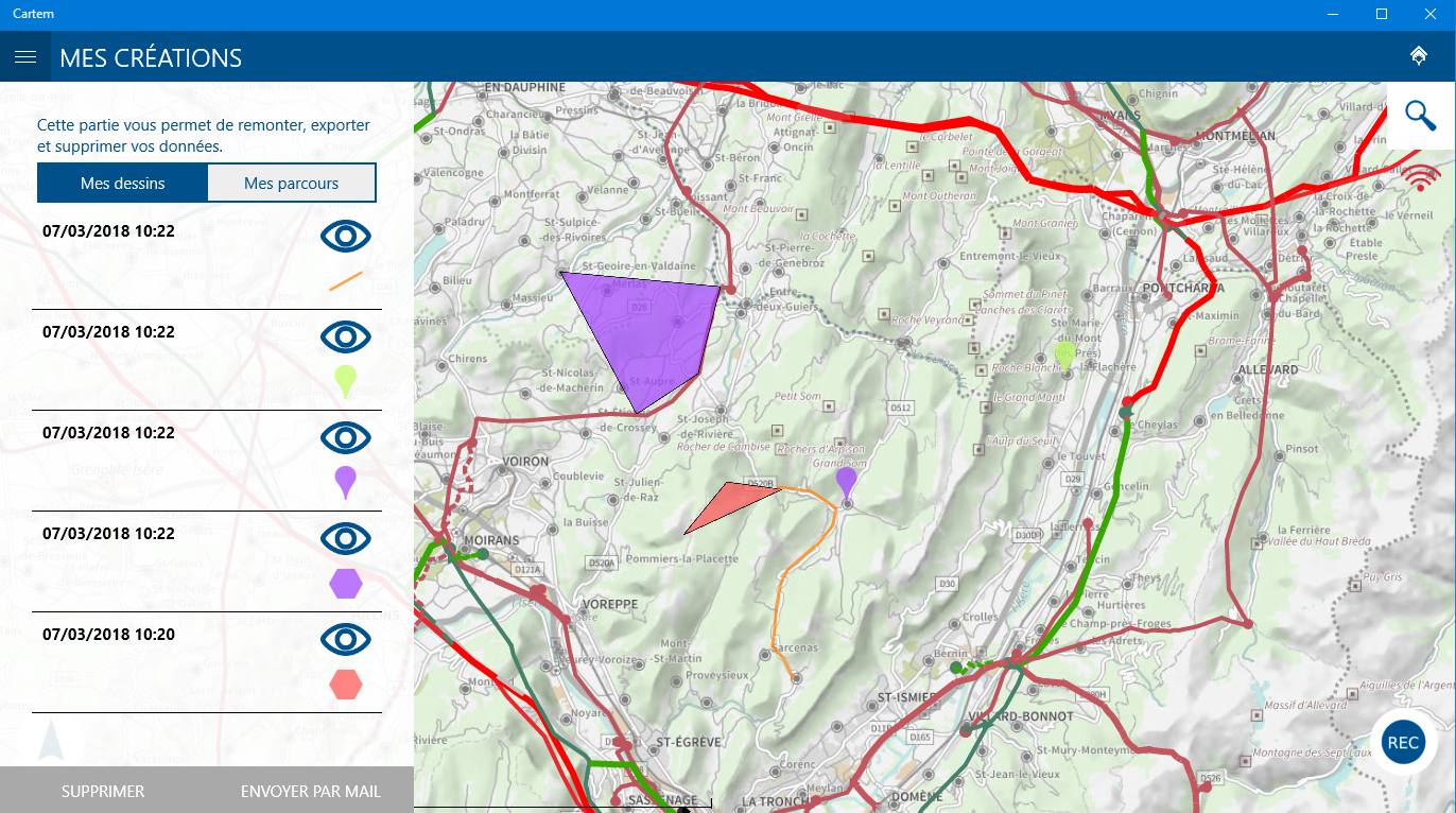
I was in charge of developing the drawing and measurement functionality of the application: Cartem users can freely draw on the map, save their drawings, and also measure distance and calculating areas.
The application can works offline: all informations downloaded online remains available in the case of a connection loss thanks to an embedded database.
Users can view their location and orientation via geolocation, and take advantage of this feature to record a route.